Lim Chu Kang is a planning area located in the northwestern part of the North Region of Singapore, bordering the Western Water Catchment to the west and south, Sungei Kadut to the east and the Straits of Johor to the north. Total Area: 17.3 km2 (6.7 sq mi) Total Population […]
Brindha
394 posts
Tampines is a planning area and residential town in the geographical region of Tanah Merah located along the south-eastern coast of the East Region of Singapore. Total Area: 20.89 km2 (8.07 sq mi) Total Population (2019): 256,730 Public Transport in Tampines Bus: 129, 15, 23 Underground: DOWNTOWN LINE, EAST WEST […]

Paya Lebar is a planning area located in the East Region of Singapore, bordered by Hougang to the west, Sengkang to the northwest, Tampines to the east, Bedok to the south and Pasir Ris to the north. Public Transport in Paya Lebar Bus: 30 Underground: EAST WEST LINE Schools near […]

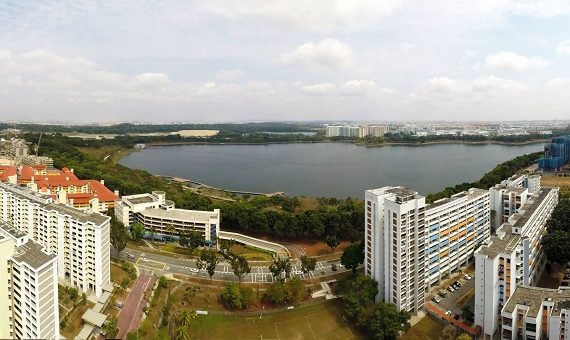
Pasir Ris is a planning area and residential town located in the East Region of Singapore. Total Area: 15.02 km2 (5.80 sq mi) Total Population (2019): 148,020 Public Transport in Pasir Ris Bus: 12, 15, 17, 5, 518, 81, 89 Underground: EAST WEST LINE Schools near Pasir Ris Pasir Ris […]
Changi Bay is a planning area located in the geographical region of Tanah Merah in the East Region of Singapore. Total Area: 1.7 km2 (0.7 sq mi) Public Transport in Changi Bay Bus: 35 Schools near Changi Bay SUTD Building 5 MindChamps PreSchool @ Changi Airport Terminal 3 The Japanese […]
Changi is a planning area located in the geographical region of Tanah Merah in the East Region of Singapore. Total Area: 40.6 km2 (15.7 sq mi) Total Population (2019): 1,830 Public Transport in Changi Bus: 118, 2, 47 Underground: DOWNTOWN LINE, EAST WEST LINE Schools near Changi The Japanese School […]
Bedok is a planning area and matured residential town located in the geographical region of Tanah Merah along the south-eastern coast of the East Region of Singapore. Total Area: 21.69 km2 (8.37 sq mi) Total Population (2019): 279,380 Public Transport in Bedok Bus: 16, 24, 45, 7 Underground: EAST WEST […]
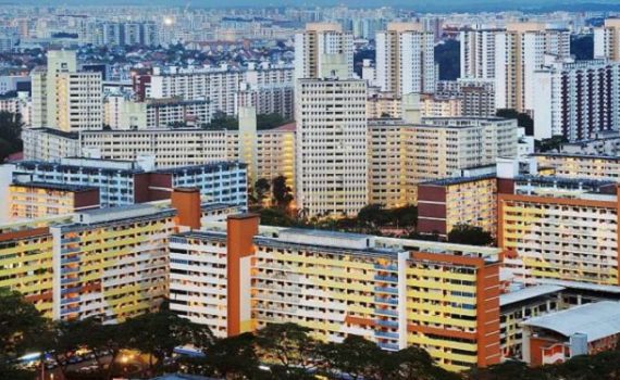
Toa Payoh is a planning area and matured residential town located in the northern part of the Central Region of Singapore. Total Area: 8.17 km2 (3.15 sq mi) Total Population (2019): 120,650 Public Transport in Toa Payoh Bus: 105, 143, 153, 56 Underground: NORTH SOUTH LINE Schools near Toa Payoh […]
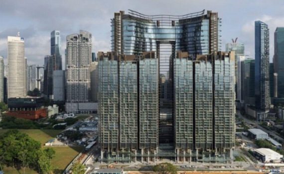
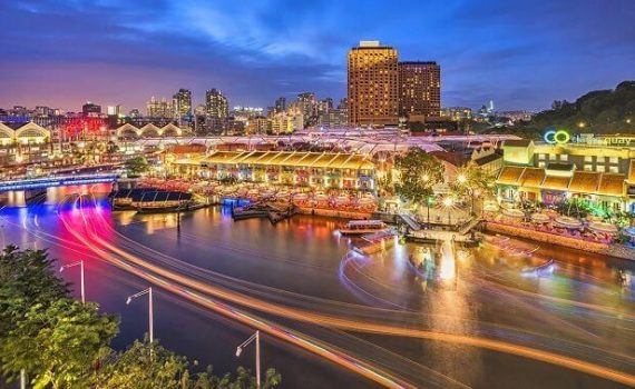
Straits View is a planning area located in the Central Area of the Central Region of Singapore. The area is currently relatively undeveloped, with fewer commercial developments compared to the adjacent Downtown Core. Public Transport in Straits View Bus: 10, 107, 97, 970 Underground: CIRCLE LINE, DOWNTOWN LINE, EAST WEST […]
Rochor is a planning area located within the Central Area of the Central Region of Singapore. Rochor shares boundaries with the following planning areas – Kallang to the north and east, Newton to the west, as well as Museum and the Downtown Core to the south. Total Area: 1.61 km2 […]